

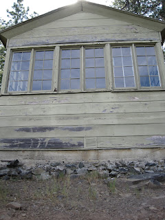
FRI: Both Sarah and I got off of work a little early and hit the road by 4pm. We sat through traffic from Novato to Santa Rosa, and from there it was smooth sailing. From 101 North we took 20 East and then onto Potter Valley Rd. We crossed the Eel River and from there the paved road turned to dirt / gravel. Roughly ten miles later we came to Soda Creek Store and crossed back over the Eel River and then headed up M1 (Elk Mtn. Rd) toward the top of Pine Mtn. Despite the horrible directions provided by the Forest Service we still managed to make our way to the Lookout Cabin. Although we made it with our Subaru Outback, the final stretch of road to the cabin on Rd 18N05 and Rd #23 is best suited for high clearance vehicles.
Just as we had hoped, we pulled up to the Cabin about a ½ hour before sunset
 which gave us enough time to unpack our gear and enjoy a glass of wine and a beer. We were very excited to have made it before dark, and our expectations of the place were blown out of the water. The views were fantastic and the feeling of serenity and solitude set in instantly.

We spent the rest of the night enjoying the sunset, drinking, eating, relaxing and observing nature. The stars, abundant and bright, ruled the dark night sky keeping our heads tilted up to gaze. In the middle of the night we were visited by some small critters inside the cabin. Luckily we have stayed in rustic style cabins before and understand that there will most likely be some mice, therefore, we packed up all of our food in a sealed Rubbermaid. The mice did not harm anything and we were able to sleep through most of their ruckus. They weren’t half as bad as the mice in the Steep Ravine cabins at Stinson Beach! A thick white soup fog also rolled in the night and we got up to look at it and the stars hanging above. The fog filled in the valley below the lookout, with tree tops poking through the shroud along its wispy edges.
SAT: We awoke early and enjoyed the sight of a soft blanket of fog covering the valley below.

As we enjoyed a slow morning with tea and breakfast the fog rose and fell several times until it finally burned away for the day. Because of its position on the mountain, the cabin remains partially shaded for most of the day. The early rising sun hits the front of the cabin first, providing a warm relaxing environment to spend part of the morning.

For most of the day we were as lazy as the lizards laying leisurely on the rocks sunning themselves.

With views as good as they were, we didn’t feel that compelled to venture too far. After a small nap...

...we got on the mountain bikes and took a short ride down Rd. # 77 to where it dead ends. The dead end actually seems like a good spot for dispersed camping as it is fairly level and offers decent views. We also noticed a singletrack trail heading up the ridge from the dead end which would be fun to explore in the future.
 We then climbed back up Rd. # 77 and headed north on Rd. 18N05 for a short ways before returning to the cabin. **All along the forest service roads are OHV trails crisscrossing back and forth. I imagine these would be fun on a mountain bike as well. Next time I will come armed with a better map and sense of direction.
We ate lunch and lounged around the cabin. At a place as beautiful as this

doing nothing feels like doing so much. The views don’t get old and we continued to soak them in. We dozed off again for a second nap, later to be awakened by several firefighters who had come to the lookout to discuss a fire they had fought in the past. We overheard their story of a brutal fire where one fireman burned to death and several others had to have limbs amputated. They listened to the one fireman scream in agony for about a half hour until the screaming stopped. While pointing to the ridge with burn scars one fireman mentioned that there were approximately 40 homes in that area, along with 30-40 million dollars worth of marijuana. Using binoculars we were able to spot a couple of pot patches.
Having relaxed most of the day we decided to get out and go for walk. We leisurely strolled south on Rd. 18N05 for about ¾ of a mile to a non-designated camping area. There were two different fire rings, one which had a large cooking apparatus used for roasting meat. Both camping areas had a picnic table and plenty of space for tents. We finished our walk and resumed full relaxation at the cabin.
We enjoyed some beverages while watching another perfect sunset.
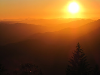


As the sun got lower in the sky it reflected a silver shimmer off of the Eel River.
 Perhaps that is how it got its name.
 For dinner we BBQ’d some marinated tri-tip and corn on the cob using the provided grill in front of the cabin.

Taking advantage of the endless amount of firewood in the vicinity, we built a large fire in the ring near the outhouse.
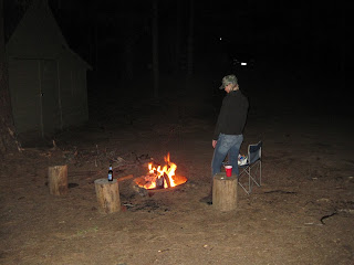
We finished off the night with classic camp dessert (s’mores).
SUN: On our last morning the fog was not as thick as the day before.

The blanket only covered patches of the valley. On the edges of the fog blanket, some of the larger pine trees protruded eerily upward.
 With check out at 12 PM we decided to pack up the car and really take in our last few hours at the cabin.
A large California Quail landed on the ground just beneath the lookout window offering a nice photo.

Checkout time came all too soon
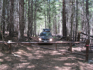
and we drove back down towards M1.
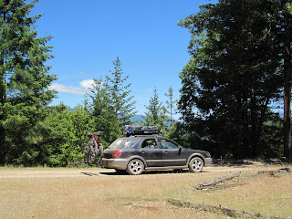 Along the way we located and stopped at the Benmore Creek Trailhead.
 A four mile trail that leads down to M8. Although it doesn’t seem to get much use, it looks like a fun technical trail to mountain bike. We drove onward to the junction of M1 and M8 where we pulled over to explore possible swimming opportunities along the Eel. Although we did not end up swimming here, we concluded that it was the least crowded, closest, and best option for swimming near the cabin. Because we spent the last two days without seeing another person except for a few firemen, we opted not to check out Lake Pillsbury as it was bound to have crowds of people in comparison. Instead, we drove back along Eel River Rd. and briefly drove through Trout Creek Campground. Operated by PG&E this campground had a nightly rate of $16, with several sites set right along the river. River access was excellent and there seemed to be some good swimming available. We found a nice spot for lunch below the Pioneer Crossing Bridge near the Van Arsdale Resevoir. Below the bridge are several swimming areas. We relaxed along the river at a decent swimming spot with a small rope swing.
 Several carloads of people pulled up to go swimming right where we were so we opted to find a different spot. On the south side of the Eel River is a dirt road that is closed several miles down due to landslides. We drove down the road a short ways to a shady parking lot with river access.
 Sarah got comfortable and dozed off in the car while I hopped on the mountain bike and rode a couple miles east along the “closed” dirt road. The road parallels the river with little elevation change, making for a nice bike ride.
 Along the road there are several trails that lead down to the river. It was hot in the sun and I forgot to bring water with me so I returned to wake Sarah from her nap. We both felt content with the trip and decided to head home. Highway 20 passes through beautiful Potter Valley.
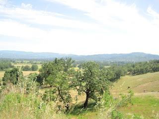 Soon after we stopped for a short walk along the shore of Lake Mendocino. The water level was so high that several of the picnic tables and pavilions near the shoreline were entirely submerged. We headed home south on 101 and we sat through traffic the whole way home from Santa Rosa.
© copyright 2010
No comments:
Post a Comment