We passed by a couple who exclaimed how beautiful the lake was. We assumed they meant Cold Boiling Lake as it is probably the main attraction for most people on this trail. I associated the couple with the only other car in the parking lot which meant we would probably have the trail to ourselves.
Intermittent clouds closed in from above like the intricate work of a cathedral ceiling adding to the feeling of serenity. Heading slightly downhill we passed the junction with the trail to Twin Meadows and followed our route a short distance further to the grassy shore of Cold Boiling Lake. Cold Boiling Lake derives its name from the Gases that rise up from beneath the ground forming bubbles at the surface, giving the appearance of boiling water.

I must say I wasn’t too impressed with the bubbling aspect of the lake. There is only one small section of the lake with significant bubbles and an ugly muddy foot path leading up to it. There is a poorly placed sign indicating Cold Boiling Lake which is a complete eyesore. That aside it did have aesthetic qualities with its borders hemmed in by vibrant green grasses and reeds.
From Cold Boiling Lake there are a couple of trail options. One could continue around the northeast edge of the lake following a trail up a ridge to Bumpass Hell and beyond. We chose to continue on to Crumbaugh Lake just a half mile further southwest.
On our way to Crumbaugh Lake we descended through a forest and then passed through another meadow, this one filled with small wandering daisies.


Before long Crumbaugh Lake came into view and we arrived at a junction with a spur trail leading to the lakeshore. We took a left onto the spur trail which led us out among the lush green grasses bordering most of the lake. Although it seemed quite marshy we made our way onto a peninsula and to the lakes edge without getting muddy at all. This was definitely a feel good place!
After referring to the topo map we decided to continue hiking to Conard Meadows. Waist deep in wildflowers we wrapped around the northwestern part of Crumbaugh Lake which lies just below the headwaters of the North Fork of the Feather River some 170 miles from the Sacramento River. This was one of those hikes where it was difficult to keep a good pace with all of the photogenic scenery. In fact, to keep from driving my wife insane I pretty much shot from the hip with my point & shoot. Bless the significant others with the patience to put up with folks like us!


We followed the trail gently downhill mostly under forest cover weaving in and out of different microclimates. At one section it felt several degrees cooler and fallen raindrops had collected on the surrounding Lupine leaves.

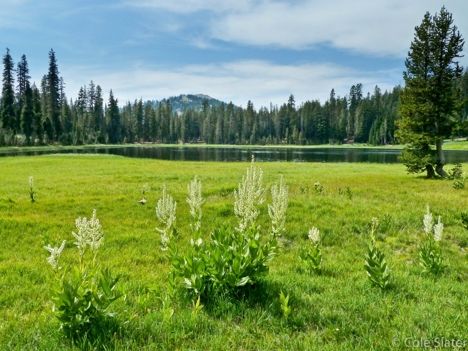
Eventually the terrain leveled out as we arrived at Conard Meadows. The meadow consisted of taller grasses, wildflowers and Corn Lilies differing greatly from Paradise Meadow. Mount Conard stood tall in the background with hefty clouds accumulating above.


We enjoyed a picnic at the edge of the meadow and watched as the sky grew darker. I scrambled off trail a short distance in the northwesterly direction before coming to a steep ravine overlooking sulfurous Bumpass Creek. From Conard Meadows if you were to continue onward, the trail descends steeply to Mill Creek Falls and then leads a couple more miles to Southwest Campground. A terrific shuttle hike is possible if you leave a car at the Southwestern Campground and start the hike from the Bumpass Hell Trailhead.
We left Conard Meadows and started the hike back uphill toward Crumbaugh Lake. I think the threat of rain subconsciously yet substantially increased our pace as we were soon wading through fields of wildflowers at the western edge of Crumbaugh Lake.


When we reached Cold Boiling Lake there was a couple of hikers by the shore so we continued onward the rest of the way to the car.
The hike to Conard Meadows was truly rewarding especially having the trail to ourselves. I look forward to organizing a shuttle hike in the future so as to incorporate more of Lassen’s natural features.
(Click HERE for a link to Lassen Hiking Associatoin and a trail map for this hike)
(Click HERE to continue reading about Day 3 of our Lassen Trip)
No comments:
Post a Comment